


-
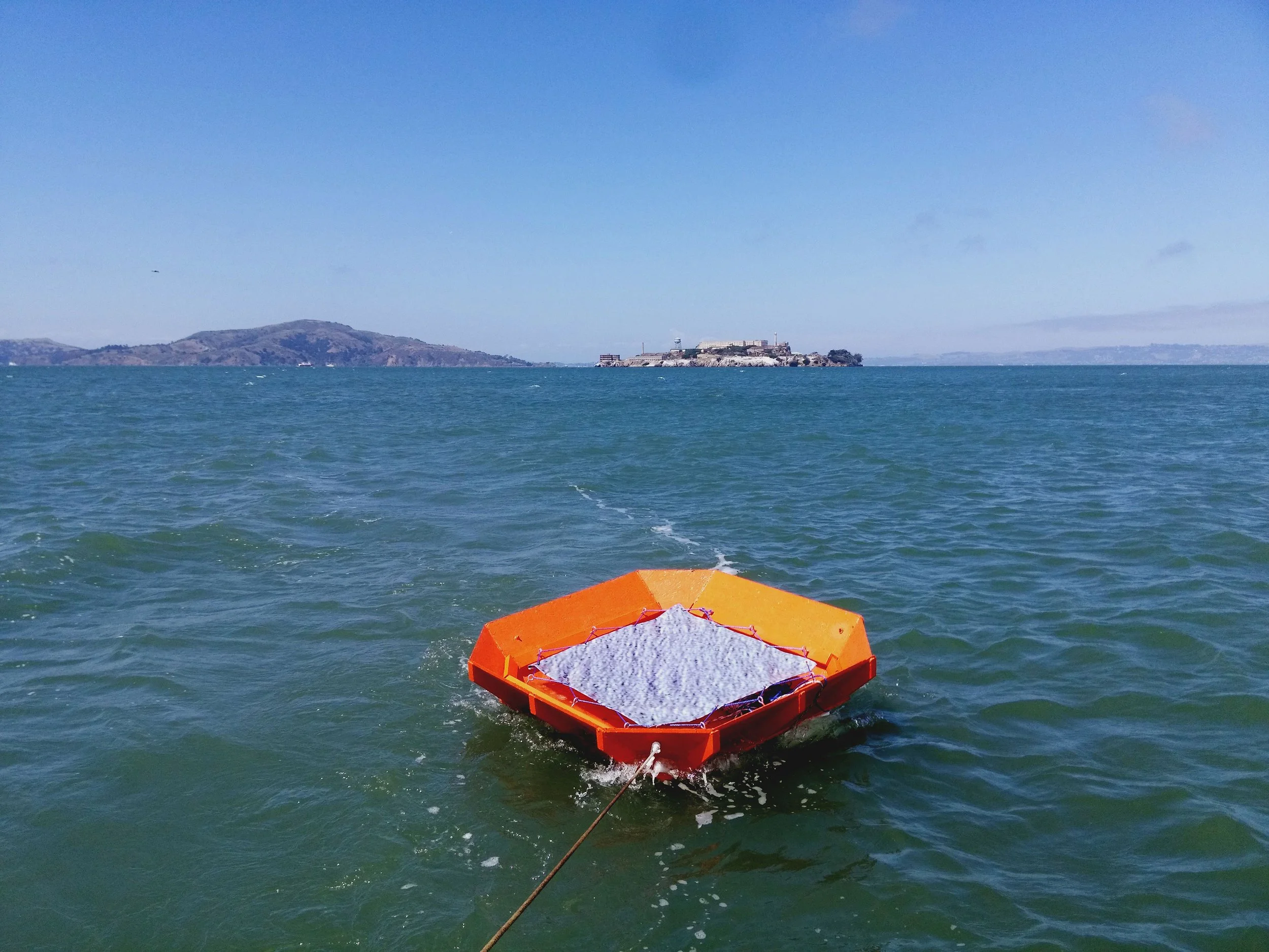
Digital print on canvas, wooden raft
3.75 x 3.75 feet (1.14 x 1.14 meters)
2015 -
The work is composed of a pixelated satellite image of water, printed on canvas and stretched across the surface of a raft. When exhibited, the raft was moored for a week at Fort Mason Center for Arts & Culture, placing an image of water as seen through satellite imaging in the midst of the changing surface of the waterfront.
The printed image shows a section of pixelated water from just outside the U.S. international boundary, drawing a comparison between the degraded resolution of the image and the deregulated and illegal nature of military activities happening offshore. Here, I was thinking specifically of the extraordinary rendition of unlawful combatants and political detainees post-September 11, 2001.
The satellite image is taken from coordinates 37°30’N 122°48’W, San Francisco’s closest point of international waters located roughly halfway between the Farallon Islands and the Peninsula.
The work was installed at Fort Mason Center for Arts & Culture, San Francisco, California in May 2015.
Watch: vimeo.com/128695051